Bristol weather: Met Office issues yellow thunderstorm weather warning - exact time it will hit

This article contains affiliate links. We may earn a small commission on items purchased through this article, but that does not affect our editorial judgement.
and live on Freeview channel 276
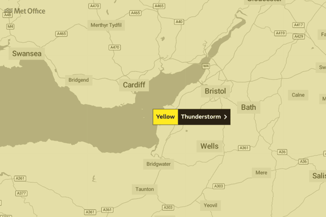
Bristol is one of the areas in the United Kingdom currently under a yellow weather warning with thunderstorms and rain forecast across the country this week.
After the heatwave that took place last week, the Met Office have issued a yellow weather warning for most of the UK and parts of Scotland with concerns that the sudden arrival of wet weather may lead to flooding in some areas.
Advertisement
Hide AdAdvertisement
Hide AdThis is due to the extreme heat conditions that have occurred throughout this summer, leaving the ground baked and unable to absorb water as quickly as it should.
Why has the Met Office called a yellow weather warning?

The Met Office can issue yellow warnings for a range of weather situations. Many are issued when it is likely that the weather will cause some low level impacts, including some disruption to travel in a few places.
Many people may be able to continue with their daily routine, but there will be some that will be directly impacted and so it is important to assess if you could be affected.
This current yellow weather warning for thunderstorms in Bristol means there could be:
- Flooding of homes and businesses could happen quickly, with damage to some buildings from floodwater, lightning strikes, hail or strong winds
- Fast flowing or deep floodwater is possible, causing a danger to life
- Where flooding or lightning strikes occur, there is a chance of delays and some cancellations to train and bus services
- Spray and sudden flooding could lead to difficult driving conditions and some road closures
- Some communities might become cut off if roads flood
- Power cuts might occur and other services to some homes and businesses could be lost
When will Bristol expect thunderstorms and the wet weather?
Advertisement
Hide AdAdvertisement
Hide AdDespite the weather warning, a yellow alert in Bristol means that there is a low to low-medium chance of the city being hit by all of the elements - but the Met Office have advised that heavy rain and thunder storms will occur from lunchtime Monday (August 15th.)
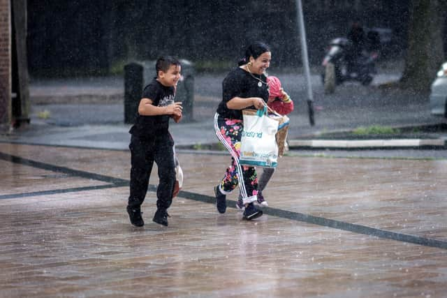
Today Bristol will have a muggy and rather cloudy start for all with some bright or sunny spells towards the north. Showers developing through the morning, turning heavy and thundery in places with a risk of hail, lightning and localised flooding - with a yellow thunderstorm warning still in effect.
Thunderstorms have been forecast in Bristol today from 5:00pm, as the tempertures this after and early evening sit between 19c and 21c.

The rest of the week:
- Wednesday: Yellow weather warning - thunderstorms (20/15c)
- Thursday: Cloudy changing to sunny intervals by early evening (23c/18c)
- Friday: Light showers changing to sunny late morning (21c/14c)
- Saturday: Sunny changing to cloudy in the afternoon (21c/15c)
- Sunday: Cloudy changing to light rain in the afternoon (20c/17c)
- Monday: Cloudy changing into light showers by late morning (21c/16c)
What is the long-range forecast for Bristol?
The Met Office has forecast that much of the prolonged rainfall in the United Kingdom will be mainly in the North of England, but that the warm weather will be returning back to parts of the south of England.
19 - 28 August
Advertisement
Hide AdAdvertisement
Hide AdCloud and rain will start moving into northwestern areas on Friday but remaining dry and bright in the southeast. A keen breeze may develop across the north and northwest towards the end of the week.
Periods of rain will alternate with drier and clearer weather over the weekend and into the start of next week. Any prolonged rain is expected to occur across northern parts. Temperatures likely near normal at first, but becoming rather warm again further into the period, especially in the south.
Unsettled conditions will likely dominate in most areas towards the end of the period, with a chance of showers in the south and some further spells of rain in the north.
29 August - 12 September
The conditions are likely to become generally more settled towards the end of August. Moving into the start of September, the north and west may see periods of rain which could occasionally spread further south and east.
Advertisement
Hide AdAdvertisement
Hide AdSome brighter and more settled periods are also expected, especially across the southern and eastern parts. Temperatures are likely to trend above average with the chance of occasional very warm spells.
How long will the yellow weather warning last?
The Met Office has given the UK, including Bristol, a four day yellow weather warning from today (August 15) until Wednesday August 17 at 11:59pm.
There are no further warnings forecast in the UK by the end of this week.
Why are there thunderstorms in the UK suddenly?
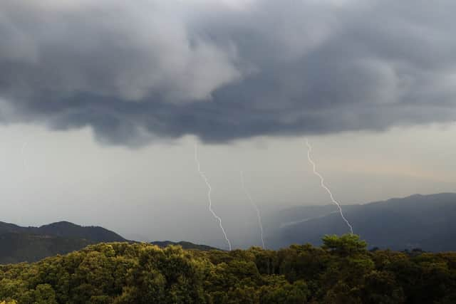
As warm air rises it cools and condenses forming small droplets of water. If there is enough instability in the air, the updraft of warm air is rapid and the water vapour will quickly form a cumulonimbus cloud. Typically, these cumulonimbus clouds can form in under an hour.
Advertisement
Hide AdAdvertisement
Hide AdA negative charge at the base of the cloud is attracted to the Earth’s surface and other clouds and objects. When the attraction becomes too strong, the positive and negative charges come together, or discharge, to balance the difference in a flash of lightning (sometimes known as a lightning strike or lightning bolt).
The rapid expansion and heating of air caused by lightning produces the accompanying loud clap of thunder.
Comment Guidelines
National World encourages reader discussion on our stories. User feedback, insights and back-and-forth exchanges add a rich layer of context to reporting. Please review our Community Guidelines before commenting.