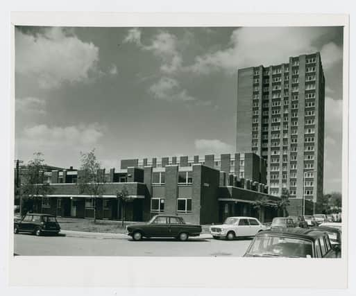
You only have to look at the number of cranes on the skyline to see that new high-rise buildings seem to be appearing in Bristol all the time.
Many of the estates Bristolians grew up on are unrecognisable compared to when they were in their younger years.
Bristol World has pulled together eight images documenting estates across Bristol either at the time of their completion or shortly after.
The areas included cover Bedminster, Brislington, Easton, Henbury, Hartcliffe, Fishponds, Two Mile Hill and Barton Hill.
The pictures were supplied by the Housing Department function on Bristol City Council’s Know Your Place site.
Bristol World has pulled together eight images documenting estates across Bristol either at the time of their completion or shortly after.

5. Gingell's Green and Hillburn Road, St Georges - c1965-1970
Gingell’s Green was included in a large development which saw Hillburn Road diverted from its original route through to Two Mile Hill, in the mid 1960s. It was built to provide housing for elderly residents and consisted of three blocks with a total of 29 one-bedroom flats. The name was derived from Gingell’s Barton, a lane of mostly 19th century cottages which was lost in the redevelopment process.

6. Merryweathers and Gilton House, Brislington - early 1970s
The photo looks down Brislington Hill. The turning on the right is Glenarm Road. During the 1960s, the council acquired two large properties on the north-east side of the road which were to be redeveloped for social housing. These would become Brislington Hill House, an 18th century mansion which had been derelict since WW2, and the Shrubbery nurseries further down the hill. The area was radically redeveloped by 1970 which can be seen in this picture. The two-storey development is Merryweathers, a block of flats for elderly residents, and Gilton House, also built for older tenants.

7. Selbrooke Crescent, Fishponds - early 1960s
Looking across Whittington Road with space which won’t be found today, this image show Selbrooke Crescent curving out of frame. The houses pictured were built in 1951. The Ford Zephyr near the centre dates the photo to 1962 or later.

8. Bright Street, Barton Hill - 1971
Cashmore House, made up of three low-rise blocks of maisonettes, can be seen in this picture, shortly after its opening. Children are found playing outside the nursery based on the site as a Vauxhall Cresta is parked at the front of the site. This was the final development in the Barton Hill compulsory purchase area which had been defined close to 20 years prior, during the 1950s.


