Bird’s eye view of Bristol: Thousands of amazing aerial images go online for the first time

and live on Freeview channel 276
Historic England has launched an incredible new online portal, which gives people the chance to explore hundreds of years of aerial photographs taken of the south west.
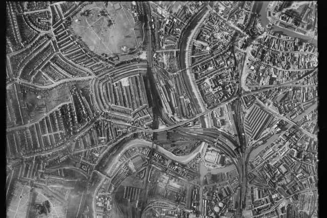
The new portal, named the Aerial Photography Explorer, allows the general public for the first time ever to search and explore an online map showing over 400,000 images from 1919 to the present day. It covers major areas of the south west including Bristol, Gloucestershire, Dorset, Wiltshire, Bath, Somerset, Devon, Cornwall, and the Isles of Scilly.
Advertisement
Advertisement
One of the reasons Historic England has launched such an extensive and generous tool to the public is because of just how much aerial photography allows you to see. It provides a fascinating insight into the development and expansion of our nation’s urban sites and the ongoing changes to rural landscapes.
Excitingly, it can also show remarkable ‘unseen’ discoveries such as crop circles and archaeology usually beneath the surface.

So where does all the photography come from, exactly? Around 300,000 of these are the work of Historic England’s Aerial Investigation and Mapping team, which was established in 1967. The images help the team to discover new archaeological sites, create archaeological maps and monitor the condition of historic sites across the country.
The remaining 100,000 images come from the Historic England Archive aerial photography collection, which numbers over two million images in total and includes important historic photography.
Advertisement
Advertisement
Rebecca Barrett, Regional Director of Historic England, said: “I am delighted that our new online tool will allow people to access easily our wonderful collection of aerial images and enjoy the historic photography that our team uses every day to unlock the mysteries of England’s past.”

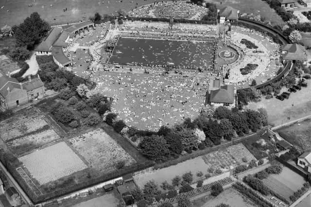
The imagery shows thousands of historic sites across the south west from the iconic Sandford Park Lido in Cheltenham to the Bishop Rock Lighthouse in the Isles of Scilly.
But, closer to home in Bristol, you can find sights such as the well-known Bristol Temple Meads, City Hall, Ashton Court Mansion, Cabot Tower, and the Suspension Bridge. With the vastness of images on display on the portal, there are also plenty of aerial shots of lesser frequented parts of the city, such as Leigh Woods, Nightingale Valley, and Abbots Leigh.
By opening up these images to the public, Historic England has created an accessible tool for anyone and everyone to explore their local area - but from a more unique bird’s eye view.
Advertisement
Advertisement
Not only can you make your own new discoveries of things you might not have known, but industry professionals and local authorities can use them to help with heritage applications and archaeological investigation.
Nigel Huddleston MP, Minister for Heritage said: “What better way to discover our shared history than through this fascinating new online tool which offers a bird’s eye view of our past. I can’t wait to discover more about my local area and encourage everyone to explore the thousands of English sites from the last century.”
Over the coming years, Historic England aims to expand the platform, as more of the six million aerial images in Historic England Archive are digitised. Discover Bristol from the sky here.