Bristol weather: flood warnings issued and weekend forecast as river levels continue to rise

and live on Freeview channel 276
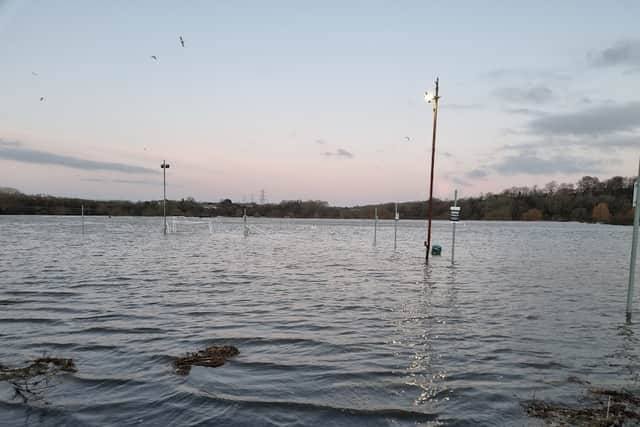
Numerous flood warnings remain in place for Bristol today (January 14), with areas of the city pictured underwater following a bout of heavy rain. Avon Fire and Rescue has urged people not to drive through floodwater and warned that river levels “are expected to continue to rise” in the county over the next few days.
The floods inflicted travel chaos for commuters on Friday (January 13) with train lines blocked between Bristol Temple Meads, Bath and Swindon. A number of roads have been closed in Keynsham, where there were reports of drivers being rescued from their cars.
Advertisement
Hide AdAdvertisement
Hide AdWater levels at the River Avon at Keynsham and Saltford are “high”, as well as at the River Frome at Frampton Cotterell and Frenchay. According to the Met Office, more rain is on the way on Saturday night through to Sunday, which could have a further impact.
Here is a full list of flood warnings currently in place for Bristol, as well as the weather forecast for this weekend.
Full list of flood warnings issued for Bristol
The Environment Agency has sounded flood warnings, which means that flooding is “expected”, for Bristol and the surrounding areas:
- Upper Bristol Avon area
- Mid Bristol Avon area
- Lower Bristol Avon area
- Bristol Frome catchment
- River Chew from Stanton Drew to the Bristol Avon at Keynsham
- Bristol Avon at Bath, riverside properties
- Bristol Avon (lower) from Twerton to Bristol
Bristol weather forecast
The Met Office said it would remain cloudy, wet and very windy in and around the city today (Saturday, January 14) turning “more showery” by mid-afternoon. Sunny spells will then develop, but it will stay windy.
Advertisement
Hide AdAdvertisement
Hide AdTemperatures will turn colder during the afternoon but remaining fairly mild for this time of year, peaking at 13 °C. There will be clear spells and scattered showers through the evening, with showers turning more frequent overnight with a risk of hail.

It will feel colder than it did on Friday night, with a minimum temperature of 2 °C. On Sunday (January 15), heavy showers will gradually ease ahead of “more persistent rain” arriving later.
It will feel rather cold in the initial strong winds, but these should ease into the afternoon. The maximum temperature will be 8 °C.
Comment Guidelines
National World encourages reader discussion on our stories. User feedback, insights and back-and-forth exchanges add a rich layer of context to reporting. Please review our Community Guidelines before commenting.